Korean startups
Korean startups join push to champion satellite data analytics market
Global satellite imaging majors are actively teaming up with Korean startups with AI-powered satellite data analytics technology
By Oct 11, 2023 (Gmt+09:00)
5
Min read
Most Read
LG Chem to sell water filter business to Glenwood PE for $692 million


KT&G eyes overseas M&A after rejecting activist fund's offer
Kyobo Life poised to buy Japan’s SBI Group-owned savings bank
StockX in merger talks with Naver’s online reseller Kream
Meritz backs half of ex-manager’s $210 mn hedge fund


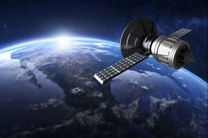
Artificial intelligence is making big changes everywhere, even in space.
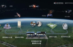
Joining an AI-controlled space war, South Korean startups armed with AI technologies that analyze satellite images and convert them into more accurate spatial data are advancing their expeditions to challenge their bigger peers through active collaboration with leading global satellite imaging companies.
Their most important mission, however, is to bloom the infant satellite data analytics market by meeting the needs of end users in diverse fields, ranging from meteorology, fisheries and agriculture to biodiversity protection, cartography, regional planning, education, intelligence and warfare.
PARTNERSHIP WITH SATELLITE IMAGING COMPANIES
According to the Korean startup industry, SI Analytics Co. (SIA) and US satellite imaging company Planet Labs Inc. signed a contract in Thailand last month to jointly provide the latter’s Earth observation images and the former’s AI-supported image enhancement service SuperX in a bundle to Planet Labs’ product resellers in Papua New Guinea, Vietnam, Malaysia, the Philippines and Korea.
The contract comes after SIA and Planet Labs in May agreed to forge a partnership to offer their products together.
SIA founded in 2018 is a Korean startup offering Earth-observing data analytics services powered by deep learning technology.
Its core product SuperX is supported by AI-based super-resolution technology, which reconstructs low-resolution images with data accumulated via AI training to present them as high-resolution images. It has been mainly used in the game and medical industries.
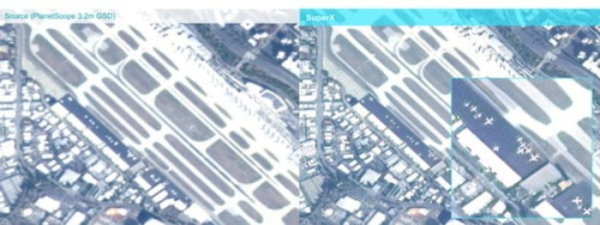
SIA has utilized the technology to develop its proprietary satellite image enhancement software aimed at improving low-resolution satellite photos.
The Korean startup’s technology has garnered interest from Planet Labs, the San Francisco-based leading Earth imaging company with a market capitalization of about $740 million, and the two companies have decided to join hands.
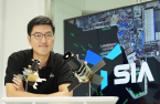
“Planet Labs is like a raw material supplier, whereas SIA is a processing company,” said Lee Po-won, general manager of Business Development at SIA. “SIA’s super-resolution technology is recognized as a core technology for image quality enhancement.”
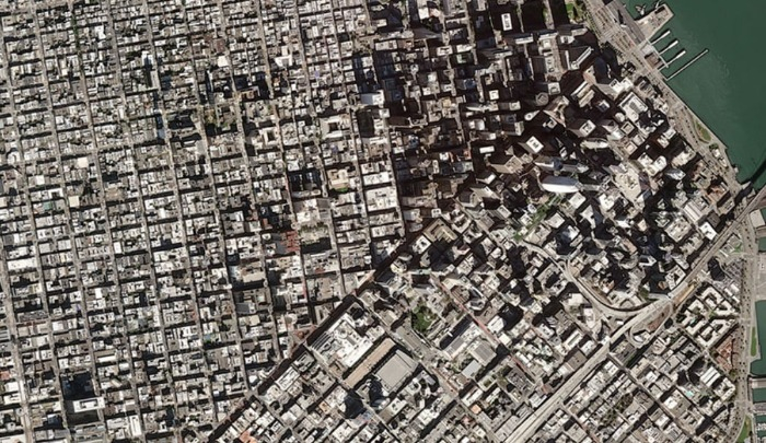
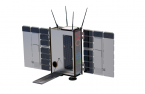
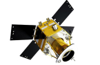
Planet Labs captures 3-meter resolution images of the Earth’s surface for 24 hours. The 3m resolution means that each pixel in the image represents a 3 by 3-meter area on the ground, which enables detailed analysis of various features and changes on the Earth’s surface.
SIA’s program can further improve Planet Labs’ spaceborne images.
The Korean startup is also working with Planet Labs’ rival Maxar Technologies Inc. on the analysis of Earth observation satellite data, while it is expected to expand partnerships with other US satellite imaging companies such as Blacksky Technology Inc. and Capella Space.
AI BEHIND RESOLUTION ENHANCEMENT RACE
Dabeeo Inc. is another Korean spatial data analytics startup actively teaming up with major players in the satellite imaging industry, including Planet Labs, Maxar Technologies and Airbus Defence and Space.
Founded in 2012, Dabeeo services deep-learning image technology INTELLIGENCE that extracts spatial data from aerial and drone images. It has recently expanded its spatial data extraction service using satellite photos.
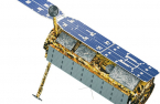
The company in February developed an AI imaging algorithm that can enhance the quality of 50-centimeter resolution satellite images to that of 25cm-resolution aerial photos. The smaller the resolution, the clearer the image.
Dabeeo uses satellite images from Maxar Technologies under their partnership deal, and they also conduct joint projects to improve the latter’s spaceborne image quality, using the former’s super-resolution technology.
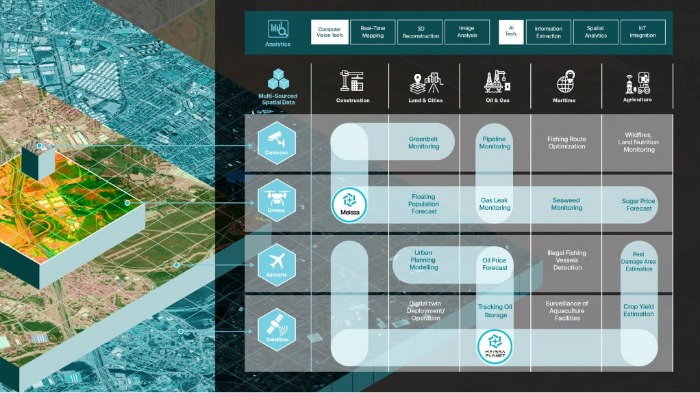
Other Korean startups NaraSpace Inc. and Meissa Planet Inc. also own similar imaging enhancement and analytics technology powered by AI.
The satellite data analytics market is expected to grow further thanks to the latest advancements in AI technology, such as deep-learning algorithm models like convolutional neural networks (CNN) and generative adversarial networks (GAN), that can refine generally low-resolution satellite images into more accurate but vast data.
IN EARLY DEVELOPMENT STAGES
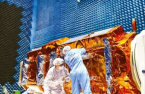
The commercial satellite imaging industry is segmented into three areas – Earth observation satellite development, satellite imaging services and spaceborne image and data analytics business.
The world’s leading imaging service providers like Maxar Technologies and Planet Labs have relied mainly on government-led projects – mostly in the military and intelligence sectors – to grow their businesses.
But with the improvement in satellite image resolutions driven by the latest AI technology advancement, demand for Earth-observing satellite data is expected to grow further, industry experts projected.
And Meissa Planet is one of the Korean startups seeking new business opportunities in the fledgling satellite data analytics market.
Meissa Planet is a joint venture set up last year by Korean spatial data platform developer Meissa Inc. and Korea’s aerospace and defense company Korea Aerospace Industries Ltd. (KAI).
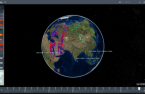
The JV purchases satellite images from Maxar Technologies and Planet Labs and then reconstructs such images with AI technology to make them more accurate. The refined images are used as multi-channel spatial data for smart construction.
Amid the shift toward the so-called New Space move, or the emerging private space industry, Meissa Planet and other AI satellite data analytics startups are expected to find more opportunities beyond government-supported projects.
“As the private satellite image analytics market has yet to blossom, existing satellite imaging companies are willing to provide their photos to AI startups free of charge or forge partnerships with them for data analysis,” said Kim Dong-young, the chief executive officer of Merissa Planet.
“If such startups create new businesses that meet the needs of various end users, that will lead to a win-win situation, in which the overall market can expand.”
AI technologies, such as super-resolution, object detection, segmentation, change detection and 3D modeling, are expected to play a key role in fostering demand for commercial satellite imagery and data in various fields, including land use, agriculture, urban planning, natural resource management and environment monitoring.
Write to See-Eun Lee at see@hankyung.com
Sookyung Seo edited this article.
More to Read
-
 Tech, Media & TelecomSK Square’s Swiss unit joins EU quantum satellite project
Mar 09, 2023 (Gmt+09:00)
1 Min read -
 Aerospace & DefenseHanwha takes over satellite technology from gov't institute
Dec 26, 2022 (Gmt+09:00)
1 Min read -
 Aerospace & DefenseHancom to launch South Korea’s first private satellite
May 18, 2022 (Gmt+09:00)
2 Min read -
 Aerospace & DefenseDefense giants eager to bolster satellite business
Feb 11, 2022 (Gmt+09:00)
4 Min read -
 Aerospace & DefenseKorea closer to independent satellite technology
Nov 22, 2021 (Gmt+09:00)
4 Min read -
 Aerospace & DefenseKorea Aerospace Industries, Airbus to jointly enter satellite business
Oct 31, 2021 (Gmt+09:00)
2 Min read -
 Aerospace & DefenseSoftware giant Hancom joins space race with satellite launch
Sep 02, 2021 (Gmt+09:00)
2 Min read -
 Korean startupsSIA analyzes satellite data for companies, government and ESG
Sep 15, 2021 (Gmt+09:00)
3 Min read
Comment 0
LOG IN